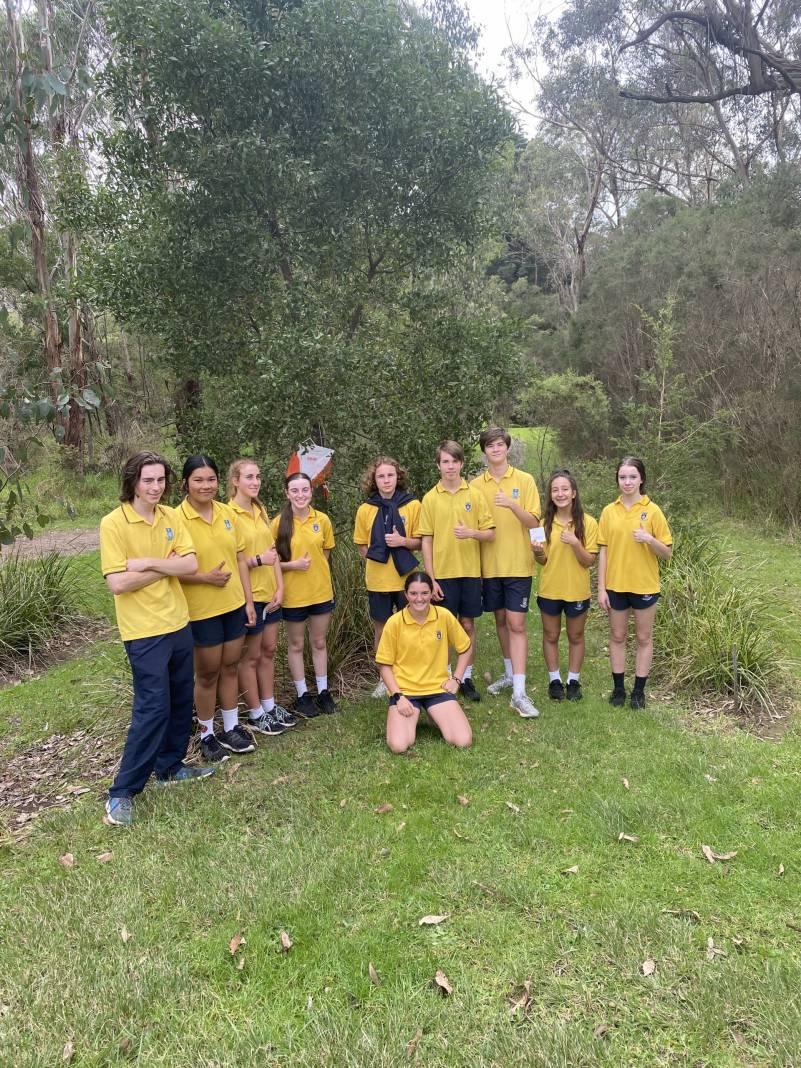
As part of the Year 10 Outdoor Education program, students undertake a navigation unit which covers map reading and compass use. Previously the class had completed an orienteering course at our College and as a culmination of the students’ knowledge and skill we headed to Mount Lofty State Park in Wonga Park on Friday 7 May for an orienteering course. The students had to cover about 3km. As well as a valuable learning experience, students had a lot of fun navigating their way around the course.
Here are some student reflections from the excursion:
We were split into groups and were given a compass and map of the park to navigate our way to the 10 checkpoints. We did this to learn how to use a compass and map properly without a teacher helping us. It was super fun and everyone had a great time while learning things. We walked up big mountains and saw kangaroos while getting to see great views from high up.
— Nancee Ripepi (Year 10 Gold)
By using maps and compasses we searched around for different stations located all around the park. By doing this, we learnt how to effectively use navigational equipment to easily locate each station and find our way around the park. I enjoyed this activity a lot because it was fun to search around Mount Lofty.
— Seb Price (Year 10 Jade)
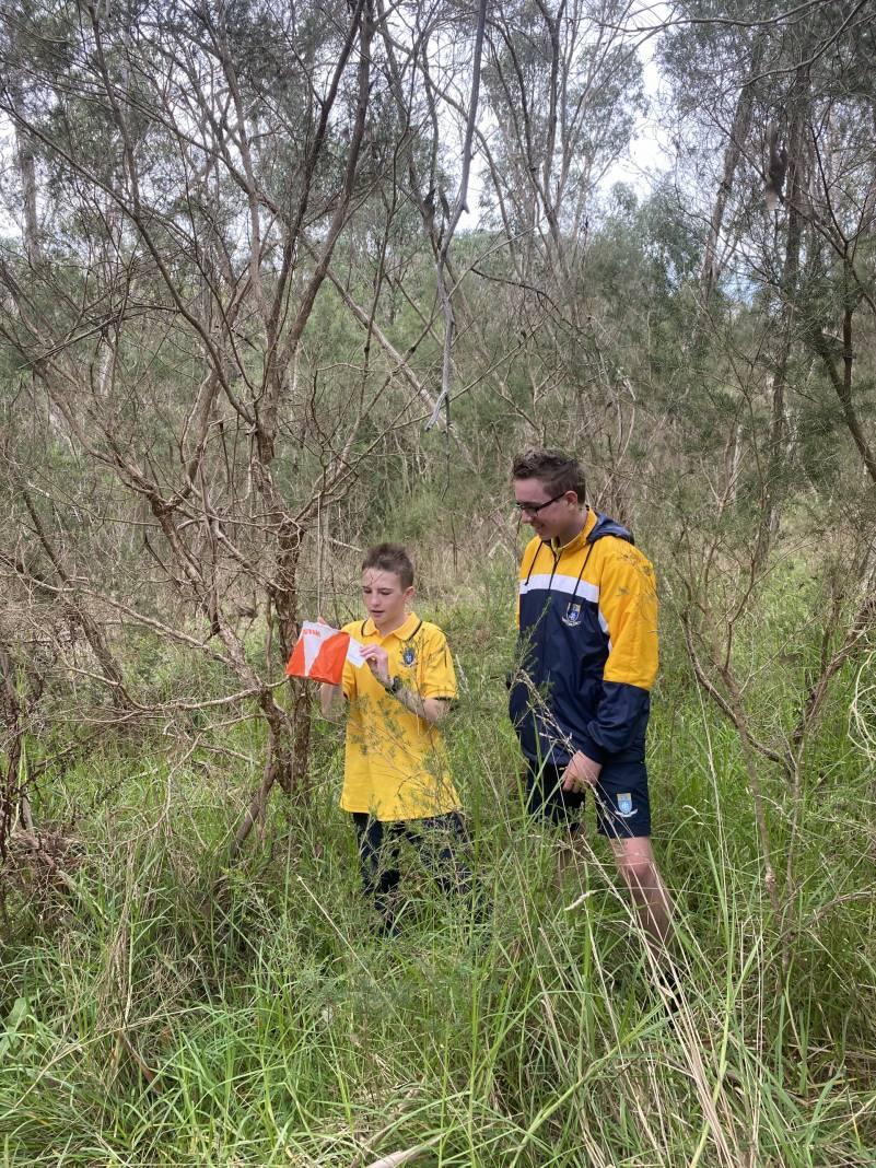
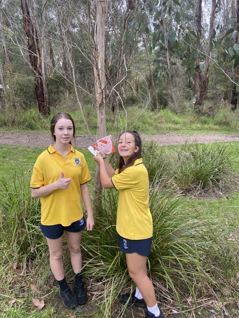
We used maps and compasses to locate the stations which were at various places throughout the park. Some of them took a bit of time to find and some were a lot easier but it was important that we didn’t miss any so that we didn’t have to go back to try and find them. I thought it was really fun to be searching for the points and it helped me improve my navigational skills tremendously. It was also good to be doing it with friends so that we could discuss where we thought the next point could be. Overall, with the lovely weather and fun activity, it was a great day.
— Josh Del Biondo (Year 10 Orange)
It was a great experience and required use of a map and compass to find the markers. What I got out of it all was that it was important that you can read a map in order to navigate around the state park otherwise you would get off track and not be able to find the markers. Which, might I add, happened a few times.
— Danya Moerth (Year 10 Orange)
Students had to have a good eye as the markers were really well hidden in the bushes and trees scattered around the trail. But in the end, thankfully, the whole class made it back in one piece.
— Hayden Foletta (Year 10 Blue)